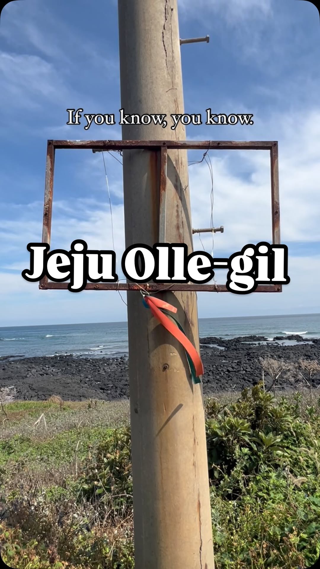
You could easily and completely miss these fluttering blue and orange ribbons that dot Jeju Island. You could visit and never see one… though they’re at numerous must see spots on the island. Once you start to see them though, you’ll find them. So, what are they? The blue ribbons, representing the ocean, and the orange ribbons, representing the Jeju tangerines, dot the trails of the Jeju Olle-Gil’s 437km long trek. There are 27 trails whoch mainly follow Jeju’s coastline and around its outlying islands, passing beaches, fishing villages, indigenous forest, tourist destinations, and urban centers. The first course I did, I walked right by not noticing most of the ribbons. But I soon became accustomed to looking for them and found them strung from bamboo branches, citrus trees, hanging on poles, and everywhere in between. Since the Jeju Olle is a trail system for hikers to walk freely and safely, the Jeju Olle Foundation offers several kinds of signage to help hikers with information about each route. Color-coded markers indicate the forward and reverse directions of each trail and are placed at strategic intervals along the trail. When you take on the trek, these fluttering ribbons quickly become a friendly sight that lets you know you’re on the right path. Have you taken a walk in Jeju and spotted any ribbons? Follow @thesoulofseoulblog to learn more about the Jeju Olle-Gil and watch as I tackle the whole thing. #jejuollegil #제주올레길 #제주도 #제주 #jeju #jejuisland #trekkingkorea #trekking
Sports/Recreation
Jeju Olle Trail - Route 16 (Gonae - Gwangnyeong Olle)