Pictured Rocks National Lakeshore Hiking Trails
Source:
@ashleyemckee


3 places on the map
Explore the map in the DocentPro app3 parks in Michigan: Chapel Falls Trailhead, Pictured Rocks National Lakeshore, Chapel Rock. Every place is verified on Google Maps, featured in an Instagram post by Ashley E. McKee | Outdoor Adventure Travel.
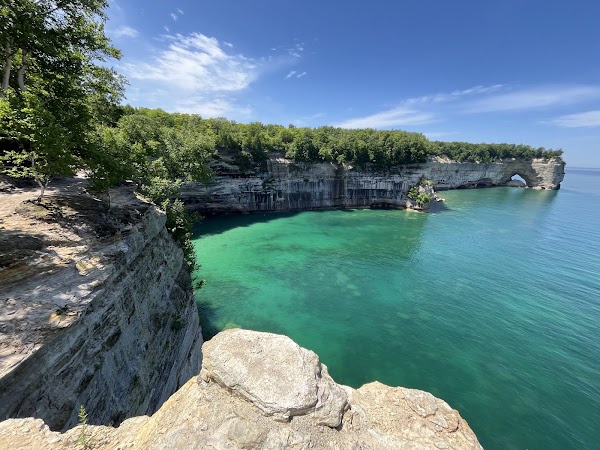
Chapel Falls Trailhead

Hiking area

4.8
• This 10-mile loop offers scenic views of Pictured Rocks National Lakeshore • Features Mosquito Falls and Chapel Falls along the trail • Moderately challenging with 774 feet of elevation gain ✓ Bring mosquito spray if hiking in the summer due to many mosquitos

Pictured Rocks National Lakeshore
Park
4.9
• Famous for its colorful sandstone cliffs and rock formations along Lake Superior • Offers opportunities for hiking, kayaking, and enjoying the clear waters • Home to landmarks like Chapel Rock and Grand Portal • One of Michigan's most iconic natural attractions
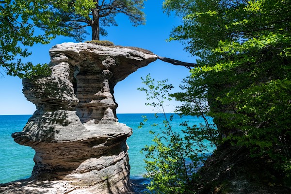
Chapel Rock
Island
4.9
• Iconic sandstone formation with a lone pine tree growing on top • Accessible via the Chapel Loop Trail • Offers stunning views of Lake Superior
Save these 3 places to your map
Keep every place on your own map in DocentPro, and add more as you browse.
More featured places in Michigan

French Onion Smashburger's Popularity Highlighted
Black Label Tavern Shelby
Seven Diverse Dining and Eatery Destinations
Fredi The PizzaMan, Peepo's Taylor, Level Zero Smash Burgers West Dearborn
Magical Head Spa Treatment Targets Scalp and Hair Health
Lumos Luxe Head Spa
Autumn Beauty at Lake of the Clouds
Porcupine Mountains, Lake of the Clouds