rcee_xandrahrain — Sai Kung Public Pier
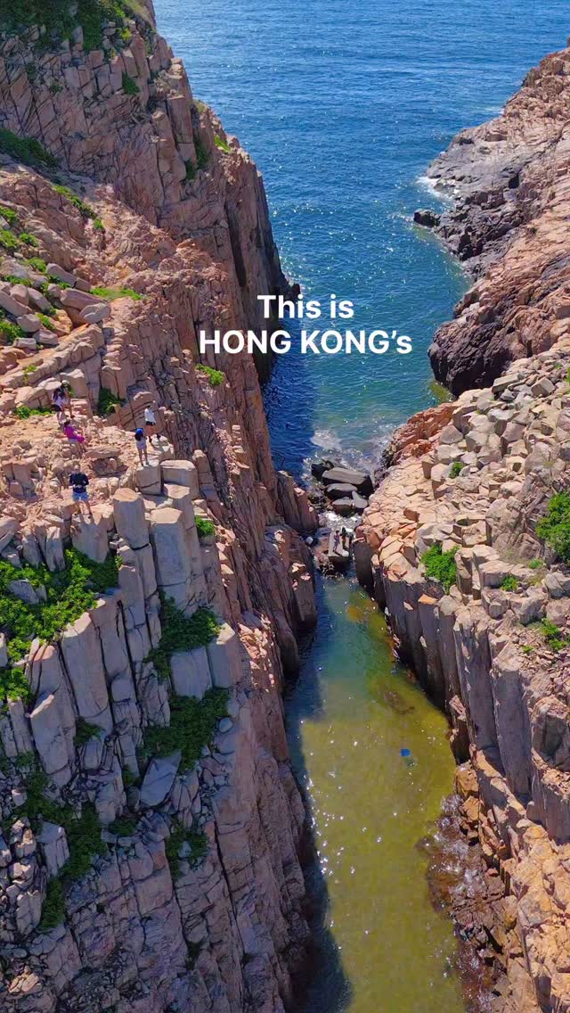
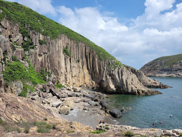
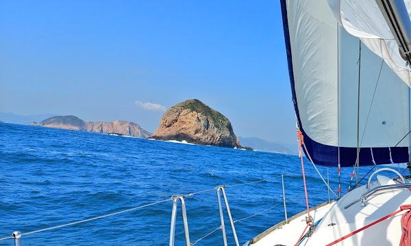
Kwo Chau Islands, 果洲群島 are an archipelago of 29 uninhabited islands, islets, and craggy rock outcroppings located in the southeasternmost waters of Hong Kong. From a distance, the islands look like a cluster of pins standing in the ocean (hence the English name “Ninepin”). Up close, they are a mind-blowing display of ancient volcanic power and relentless ocean erosion. The archipelago is primarily split into three main areas: North Ninepin, South Ninepin, and East Ninepin. While North Ninepin is defined by its standing columns, South Ninepin is defined by the sheer power of sea erosion, featuring incredible sea caves and deep fissures. Because the islands are completely uninhabited and have no public piers, paved hiking trails, or visitor facilities, visiting them requires some planning. They are completely exposed to the open Pacific, meaning they are prone to heavy tides and rough swells. To get here, some chartered speedboats (like those departing from Sai Kung Pier) will allow experienced hikers to disembark onto the rocky edges of North or South Ninepin. #hongkong #ninepinislands #islandhopping
Attraction
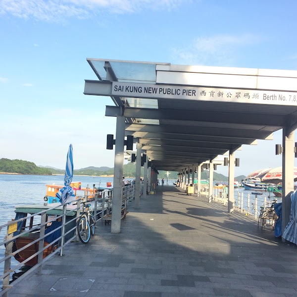
Sai Kung Public Pier
Landmark
4.1
Buzzy pier with tour operators offering rides to outer islands, plus just-caught seafood for sale.
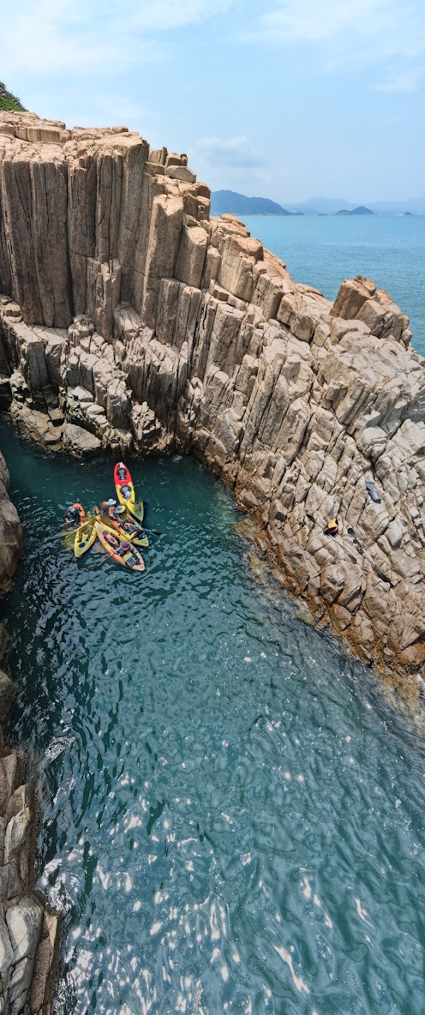
North Ninepin Island
Natural feature
4.9
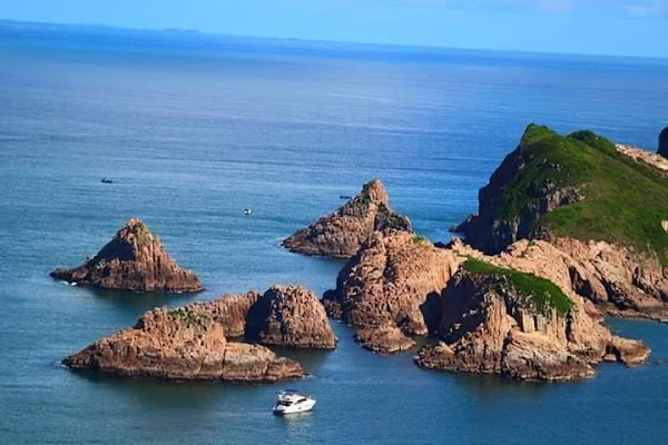
Kwo Chau Islands
Natural feature
4.7
Small archipelago of rugged, volcanic islands with sea caves, stone arches & 6-sided rock columns.
South Ninepin Island
Natural feature
4.4
East Ninepin Island